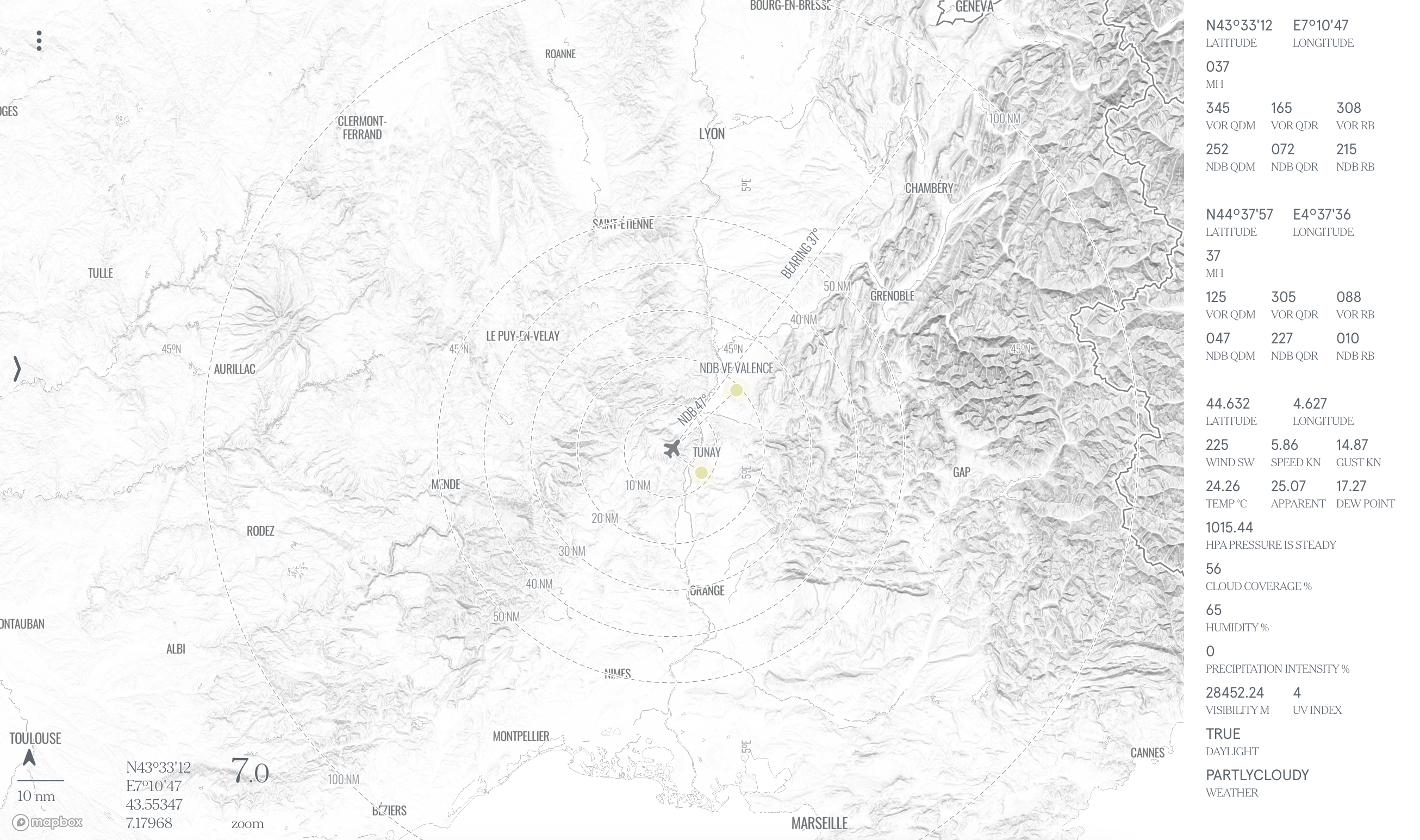
flight planning with realtime nowcast and forecast weather on fast, stable and highly available map. meteorological layers by national oceanic and atmospheric administration NOAA, openweathermap and Apple Weather. an experimental interactive collaborative platform prototype of geospatial content. development and design ©2026 by gerd tunay schuster
please be informed that the flight planning with this application is for rough orientation only and may not be used for real flights. Use at your own risk. please confirm all weather datas at the original source. these are for internal information only and may be wrong, out of date, or incomplete. app.tunay.io assumes no liability for the correctness, accuracy, relevance, reliability or completeness of the information published.
made with love in munich
licensed under CC BY-NC-SA 4.0 Creative Commons Attribution-NonCommercial-ShareAlike 4.0 International